
War Property Records: Search by Route and PID
Open the statewide assessment application first. Pick the McDowell County result matching the War address, route, or owner. Copy the full PID. Keep the district, map, parcel, and suffix together. Note any E-911 text listing multiple addresses. The County Clerk's deed index confirms the recorded transfer, the tax inquiry covers the bill, and MapWV puts the surface parcel on screen. Because a route address and a Welch mailing city can both sit on one War-area card, verify the map key and legal description before trusting the location.
- Search the assessor application using the route, E-911 address, owner name or tax-map key.
- Copy the full PID and compare District 14 War Corp, map and parcel components.
- Use the book/page and legal description to confirm the deed in the County Clerk index.
- Check the tax account separately and view the surface parcel in MapWV.
- Contact War's municipal office about permit or zoning records; no public search form was found.
The McDowell property-search guide walks through each county system. For War, keep the route label and the parcel district together through every lookup.
War Creek, Miner’s City and the 1920 Incorporation
War takes its name from War Creek. The town incorporated in 1920. Older references call the mining community Miner's City. A search limited to the present postal city can easily miss that label. War sits near the confluence of War Creek and Dry Fork. Because of that, an older land description may cite a creek, branch, highway, mine addition, or lot instead of a numbered street.
Keep the community name in your notes. Keep the waterway language too. Search the present name and the older mining-community label side by side. Then verify each hit against a legal description and the modern PID. Incorporation gives War a municipal context. But it does not create a separate deed index. So the county books still carry the records.
War Property Records in County and Town Files
The County Clerk's deed index and plat records, the county assessment roll, and the state parcel viewer cover the land chain, the owner field, and the map. Tax tickets run through a separate online inquiry service. The municipal office holds ordinances and street files. The town offers no searchable portal for building permits, zoning, demolition, code enforcement, cemeteries, or business licenses. Ask the town directly for a file. Its contact page is not a permit database.
McDowell County Land Records
Use the county assessment roll for the owner and parcel card, then follow its book/page to the County Clerk index.
War Municipal Office
PO Box 280
War, WV 24892
304-875-3111
War Creek and Dry Fork in Property Descriptions
Creek and branch geography explains why waterway language often beats a street address in War. The town lies where War Creek meets Dry Fork. An older deed may name a creek, branch, highway, lot, or mine addition. Match that wording to the current physical address. Check the E-911 note on the assessment card too.
The state viewer places the surface parcel next to nearby land. It can also display flood context in the narrow valley. Neither the parcel edge nor any overlay is a surveyed line. Neither is an elevation finding. For exact ground location, rely on the legal description. And rely on a qualified survey as well.
War ZIP 24892 and Property Records
ZIP 24892 serves War and nearby addresses, but its coverage reaches routes beyond the incorporated town. A War mailing label alone is not proof. Check the District 14 map designation, the full PID, the physical address, the E-911 detail, and the GIS polygon together. If the municipal boundary itself matters, ask the town for its official boundary record.
The distinction matters most when an owner's mailing line says Welch while the land sits in a War-area district. Postal geography answers delivery questions. Parcel geography answers ownership and location questions. The two are related, but they answer different questions.
War Property Records for Additions and Plat Names
The War corporation district is on record. So is a Big Creek surface description. No authoritative list of named town additions or subdivision plats exists for War. Do not substitute Welch neighborhood names. Do not invent construction eras either. The practical path runs through the County Clerk's plat and deed books alongside assessor Map 14, so request plat names and book/page references from the Clerk or the assessor map room before treating any community label as a recorded subdivision.
| Neighborhood / Subdivision | Era | In the Records |
|---|---|---|
| War Corp district area | Municipal mapping area; subdivision era not established | District 14; use the map and PID, not as a plat name |
| Big Creek surface parcel | Sample card gives no plat or construction date | Legal description “6.68 ACS BIG CREEK SURF”; Map 0003, Parcel 0078 |
| Creek, branch and route locations | Individual parcel dates not confirmed | Preserve waterway and highway wording from each deed |
Search with the district, map, and parcel key. Ask the Clerk for a recorded plat. A book/page reference or an owner name works for the request. Match the legal description against the map and assessment card, since map lines are reference aids rather than a boundary survey.
War Property Records in District 14
One War-area assessment card shows how the numbering works. The PID 27-14-0003-0078-0000 breaks down as District 14 War Corp, Map 0003, Parcel 0078, with suffix 0000. A Welch mailing address appears on the card. The physical route address is S S WV Route 16, and an E-911 note refers to multiple addresses. The description reads “6.68 ACS BIG CREEK SURF,” with 6.680 deeded acres. The calculated acres come to 6.73, and the card lists two building cards. The owner of record is the McDowell County Board of Education.
This institutional parcel is a useful example. It is not a template for every house or addition in War. The full PID and the physical fields locate the land. They work far better than the Welch mailing label.
The assessment card displays the parcel and improvement fields: View the War district sample card for this guide.
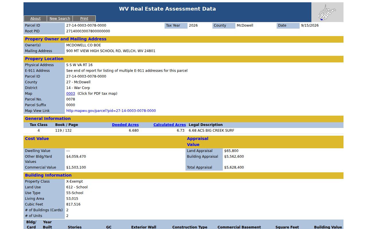
Compare the sample card's Map 0003 reference directly with any subject property's map fields rather than inferring its location from mail routing.
War Property Records and the Welch Mailing Address
A War-district parcel can carry a Welch mailing address. The school card shows the pattern: mail goes to Welch while the property itself sits along a state route in District 14. A single E-911 field may also cover several addresses. Postal labels alone can mislead. When results look inconsistent, search McDowell County property records by district and PID instead, comparing the site address, E-911 note, book and page, acreage, and legal description side by side. Keep every address variation. One may tie a new map entry to an older route or creek description. That thread often straightens out a confusing parcel match.
Request War Permits and Street Records
The Secretary of State municipal directory lists War at PO Box 280, War, WV 24892, phone 304-875-3111. The municipal page publishes no online search. That covers building permits, zoning, demolition, code enforcement, cemetery records, and business licenses. Contact the town office. Ask whether it holds an address-keyed file, paper permit, street record, or ordinance relevant to the parcel. Include an address, a current or prior owner or applicant, an approximate year, and the exact record category in the request. Fees, forms, and retention periods are unlisted. Ask those questions when you call. Open War's official municipal page for the town contact route.
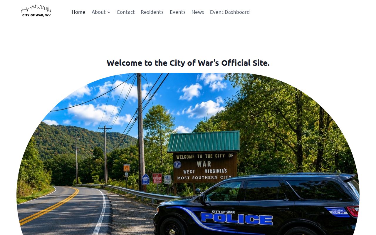
The city page provides a contact lead, not a searchable permit history.
War Property Records and Institutional Value
The War school card lists land appraisal of $65,800, building appraisal of $5,562,600 and total appraisal of $5,628,400 for Tax Year 2026. It records Tax Class 4, land use 612 School and 53,015 square feet across two building cards. This value story is about a large public-use parcel and its improvements, not a detached home trend. No official War district sales or value-trend series was found.
West Virginia generally assesses property at 60 percent of true and actual value as of July 1, with annual updates and a repeating three-year visit cycle. The assessment total is not a sale price. A deed's recorded consideration is a separate transaction fact and may not represent today's market value.
War Property Records: What They Establish
A War parcel card can show the owner, assessment value, mailing and site addresses, PID, district, acreage, and legal description. A deed records the conveyance. The viewer maps the surface tract. None of these guarantees that every coal or mineral interest is included, identifies an occupant, proves a boundary on the ground, or supplies a current market appraisal. Annual state publication can lag a closing. The deed portal also warns that items still in processing may be absent online.
The District 14 school card illustrates several limits at once. It names the McDowell County Board of Education. It gives a Welch mailing address, places the property along S S WV Route 16, and notes multiple E-911 addresses. The details rarely agree perfectly. The two acreage figures nearly match. They still come from separate fields, 6.680 deeded acres against 6.73 calculated acres. Treat the card as an example of address and map keys to compare. It does not describe every War parcel or serve as a market comparison for a home.
War's municipal office is listed at PO Box 280, War, WV 24892, phone 304-875-3111. Call before visiting. The town offers no public online permit or zoning search, so a resident or researcher should identify the address, applicant, or approximate year and then request the particular paper or administrative record from the town. The office contact page is a route to ask. It is not evidence that a permit record exists or that the municipality holds every file.
Lawful use. Use War records for lawful property research, ownership diligence and civic transparency. Do not use owner information to stalk, threaten, harass or harm anyone.