
What McDowell Parcel Maps Display
MapWV pulls together assessor GIS layers and annual tax data into one parcel viewer. Pull up a McDowell parcel and you see it set in its county map context. A path to related assessment details sits right there too. A flood overlay helps in the county's tight valleys, though it stays a reference layer. The state page itself warns that the assessor holds the most current data. Annual publication can trail a recent closing. Treat any map feature as a lead. Confirm it against the tax-map PDF and the recorded description before relying on it.
| Layer | What It Shows | Use |
|---|---|---|
| Surface parcel | Mapped tax parcel and map context | Locate the assessment parcel and surrounding land |
| Parcel identifier | County, district, map, parcel and suffix components | Carry the same PID to assessment and tax records |
| Flood display | Flood-risk overlay available in the viewer | Review as a screening reference, not an elevation survey |
| Tax-map PDF | County map sheet when the link is available | Compare map context with PID and deed description |
| Assessment link | Owner, appraisal and legal-description card | Verify the selected parcel in the state roll |
Use the parcel number from the map. Reopen the assessment record, then follow its book/page into the County Clerk's deed index. A tax map is not a recorded conveyance. The viewer certifies no owner. It sets no boundary either. If the legal description names a subdivision lot, creek, road, survey, or older community name, carry that exact language into your deed or plat check.
MapWV's McDowell parcel view shows the selected parcel alongside its available map tools. Open the West Virginia Property Viewer and select the McDowell parcel of interest.
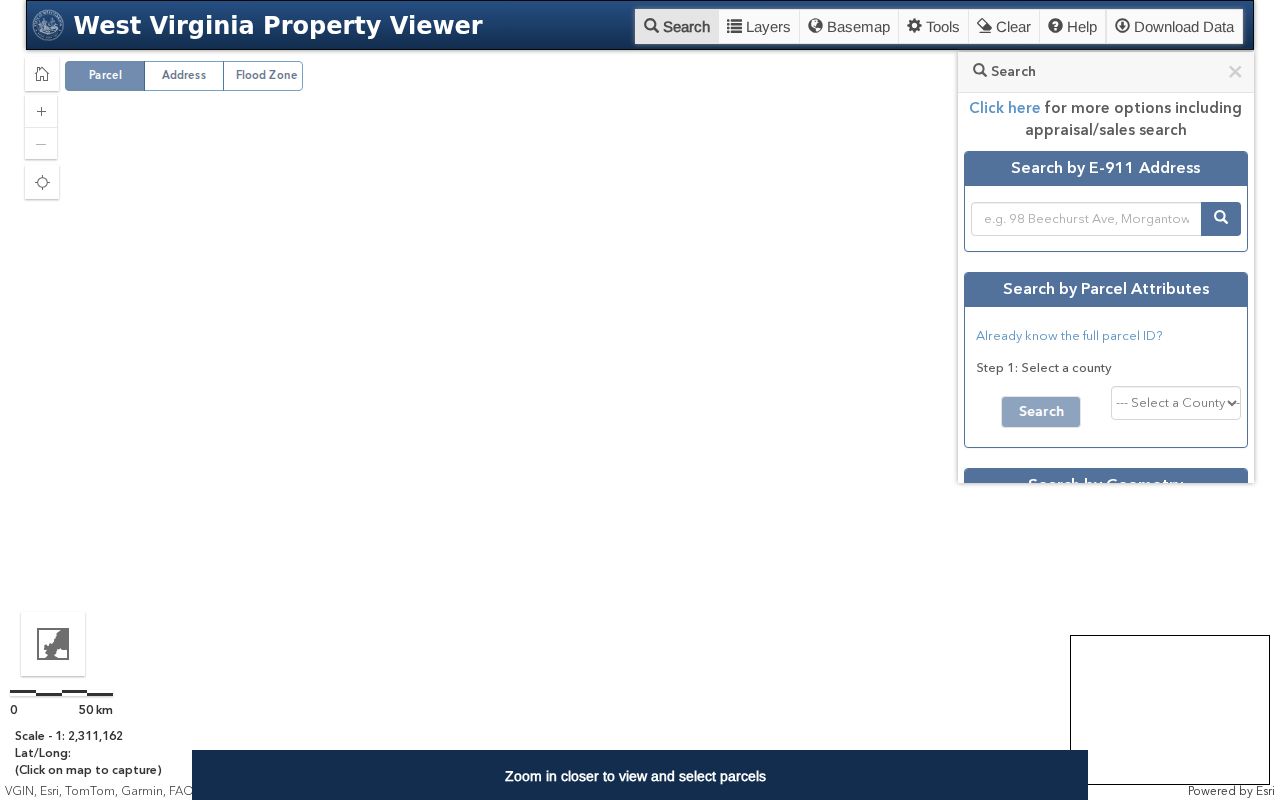
Use the display to spot the record worth verifying, not to fix a legal boundary.
Reading a McDowell Parcel ID
A West Virginia PID packs county, district, map, parcel, and suffix fields into one string, with a special ID where one applies. McDowell's county code is 27. The district can hint at a corporation area. Assessor examples include District 15 Welch Corp and District 14 War Corp. The full PID beats a mailing city. A parcel in the War district can still carry a Welch mailing address. Copy every component from the card. Match it to the tax map and deed.
The district number is an assessor mapping key, not a ruling on municipal boundaries. Check the mapped polygon and local context, and never treat a postal ZIP as a city limit.
Finding a McDowell Parcel from an Address
In MapWV, search or zoom to the address and click the apparent surface parcel. Write down its PID. Open the assessment card next. Compare the owner, physical address, E-911 address, book/page, and legal description. Check them against what the map suggested. The street address may not pin one parcel. Then search the assessment application by owner name. Or assemble the district-map-parcel pieces from an older deed. A rural route, branch, creek, or highway may be the only location phrase in the record. Lean on more than one clue.
- Locate the address or nearby route in the MapWV parcel viewer.
- Select the surface parcel and copy its full PID and any visible map reference.
- Open the related state assessment card and compare its situs, E-911, owner and legal-description fields.
- Follow book/page into the deed index and compare the tax-map sheet or recorded plat.
- PID
- The state parcel key built from county, district, map, parcel and suffix parts.
- Tax map
- The assessor's mapped parcel reference, useful for locating a sheet and parcel.
- Plat
- A recorded map or subdivision plan filed with land records.
- Legal description
- The deed language identifying the land by lot, survey, calls or another description.
McDowell Deeded Acres and Calculated Acres
An assessment card can show both deeded acreage and a separately calculated area. The Welch sample lists 1.088 deeded acres against 0.58 calculated acres. Those two values differ materially. The War school parcel shows 6.680 deeded acres and 6.73 calculated acres, a near match. The figures come from different processes. Never swap one for the other in silence. Read the deed's acreage language, and ask the assessor how the mapped calculation was produced when a card seems inconsistent.
A GIS polygon exists for tax mapping and reference. It is not a field survey. Its visual area cannot settle possession, fence placement, or a right-of-way, so bring in a licensed surveyor before construction or any legal decision.
McDowell Surface Parcels and Mineral Interests
McDowell parcels on the state viewer show surface ownership only. Much county land hides a second story below ground. Mineral rights, coal-era reservations, leases and assignments can belong to someone else entirely. None appear as separate surface polygons. An assessor parcel, in other words, is not a complete ownership map for subsurface rights. When those interests matter, search the deed chain. Look for the language that created or moved them.
Coal companies, railroads and older landowners often appear under varied names. Carry each name into the Clerk's deed index. Compare each instrument's legal description. MapWV still shows the current surface parcel. The deeds and plats explain the rights and divisions recorded over time.
Two sample assessor cards show why the map is one layer, not the whole answer. The Welch parcel is PID 27-15-0002-0363-0000 in District 15, Map 0002, Parcel 0363. The War school parcel is PID 27-14-0003-0078-0000 in District 14, Map 0003, Parcel 0078. Both keys keep a live link to the assessor card. The War example uses a Welch mailing address and a route-style physical location anyway. Match the complete key, not the postal label, when choosing a polygon.
Acreage needs the same care. The Welch card reports 1.088 deeded acres and 0.58 calculated acres. The War card reports 6.680 deeded and 6.73 calculated. One figure is recorded; the other is mapped. The drawn shape can help you locate a tract. It cannot settle a legal acreage. Use the deed's calls, a recorded plat and the assessor map reference. Together they show how the tract was described and later mapped.
Flood context is a separate display. A flood layer can flag that a parcel sits near mapped flood information. That is useful in a narrow McDowell valley. It provides no site-specific elevation certificate. It also does not decide whether one structure is at risk. Frame your question for the relevant mapping or planning authority, and rely on site-specific professional review when a purchase, construction or insurance decision depends on it.
When a McDowell Parcel Map Lags a Deed
The assessment viewer is published annually. The state cautions that a recent closing may lag. Parcel-line changes from the July 1 through June 30 transfer period face a February 1 submission deadline in the following calendar year. After two years, contact the assessor directly. That lag explains the odd combinations a searcher meets. A new deed can sit beside an older PID and a prior tax map during a transition.
Keep both the previous and current PID when a tract was split or combined. Compare the recorded date and description with the assessment year and map sheet. Still inconsistent? Ask the assessor whether a revised map has been submitted. A screenshot of the viewer never alters the recorded conveyance.
McDowell Plats and Neighbor Parcels
A subdivision plat or an older deed map can clarify how lots relate to roads and neighboring tracts. The County Clerk maintains the recorded plats. The assessor map and MapWV identify the present surface parcel. Together they frame any boundary question. The viewer's parcel display can gather IDs for adjoining polygons. The viewer offers no select-adjacent or buffer tool. Click and verify each nearby parcel rather than trusting an automatic neighbor list. Open a neighbor's assessment card from its PID. Compare the legal description and deed chain before concluding anything about shared ownership or a shared boundary. For a block-wide lookup, the neighbor guide carries the fuller process.
What McDowell Parcel Maps Cannot Prove
MapWV is a tax and geographic reference, nothing more. Its parcel lines are not survey lines. The flood display is not a site-specific elevation determination. Publication each year can lag a recorded split. The state calls the assessor the most current source for assessment information, yet the assessor's roll is not a title search either. Use the map to find the right card and document, then let a licensed surveyor resolve a ground boundary.
Not a survey. Do not set a fence, structure or legal claim from a McDowell GIS line. Ask a licensed surveyor to locate a boundary on the ground.