
Records for the Parcels Around a McDowell Property
A block begins with one parcel. Open MapWV, find the subject tract, and note its full PID. Then work through the nearby shapes one by one. Take each neighboring PID to the West Virginia assessment site to see owners, mailing addresses, legal descriptions and tax years. The County Clerk's plats and deed records help when a shared lot, road or easement needs explaining. The viewer offers no buffer tool. Build the list from the parcels you can see. Do not assume an automated result covers every adjoining tract, since quiet gaps in coverage are common on steep terrain.
| Source | What It Shows About a Block | Access |
|---|---|---|
| MapWV parcel viewer | Surface polygons and visible parcel context around the subject | Public viewer; adjacent-selection tool not confirmed |
| Assessment roll | Owner(s), mailing and site addresses, PID and appraisal fields | Public annual assessment search |
| County Clerk plats and deeds | Recorded lot layout, conveyance descriptions and easements | Online index and Clerk's older record channels |
| Tax-map sheet or survey | Map reference or surveyed boundary information | County map PDF; licensed survey for legal line |
The assessment roll names an owner of record, not the person using the building. It may list a company instead. The assessor offers no street-wide search. So the map-and-PID method is the supported path for building a block list of McDowell parcels.
Map McDowell Parcels Around the Subject Lot
Start in the state parcel viewer. Move to the subject address or the surrounding route. Select the apparent parcel and copy its PID. Then inspect each adjoining polygon, keeping a running list of IDs and map references. Reopen each one in the assessment application to confirm that its physical address and legal description match the map location. Selection can be tricky on small tracts. Cross-check with the tax-map PDF or assessor card rather than guessing an owner's name from a label. The official MapWV parcel page displays a selected McDowell parcel with its viewer context. Open the MapWV parcel viewer to find surface parcels.
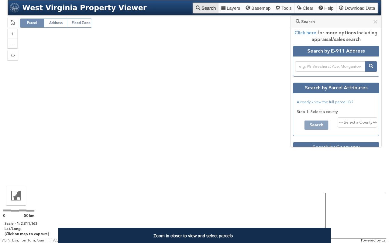
Confirm every adjacent PID against its assessment card and recorded description.
Build a McDowell Block List by Parcel
A block list is a set of verified parcels. Names guessed from a street will mislead you. Begin with the subject parcel and follow each visible adjoining shape, copying every PID as you go. Check owners and mailing addresses in the assessment roll. Then turn to deeds or plats if a line, easement or lot relationship stays unclear. McDowell valleys are narrow. Parcels often run along a creek or route, so a straight-line neighborhood radius can miss tracts separated by steep terrain or a stream.
- Locate the subject property in MapWV and write down its district, map, parcel and suffix.
- Inspect the visible adjoining parcels and copy each candidate PID separately.
- Open every candidate in the assessment roll and confirm owner, address and legal description.
- Compare plats and deed descriptions when a shared line or right-of-way is important.
- PID
- The county, district, map, parcel and suffix key for the assessment parcel.
- Adjacent parcel
- A mapped parcel that appears to share an edge; the map is not survey proof.
- Buffer
- A distance area around a parcel; a dedicated MapWV buffer tool was not confirmed.
War Route Addresses and Multiple E-911 Entries
Postal labels in the War district can be confusing. One parcel can carry a Welch mailing address, a physical route description, and an E-911 note listing multiple addresses. The school parcel illustrates this. It sits in District 14 War Corp, Map 0003, Parcel 0078, yet its mailing address is in Welch and its site address sits on S S WV Route 16. Sort by parcel, not by postal city. The PID and polygon anchor a War-district neighbor lookup far better than a ZIP code. Nearby properties often use route, branch or creek names. Keep the displayed E-911 note with each parcel. It can clarify which buildings or access points relate to a parcel without proving the position of a legal boundary.
Welch Edge Addresses and McDowell Neighbors
Welch ZIP 24801 covers the courthouse, assessor mailing examples and city addresses alike. Postal geography proves little. A parcel near the edge can carry a Welch mailing city while sitting in an adjoining community or unincorporated pocket. Compare several fields before trusting a neighbor list. Check the owner's mailing line against the physical address, the E-911 address, District 15, the map, the PID and the legal description. One assessor sample lists a Nashville mailing address. Its site address is in Welch. The physical parcel is the geographic key, since the mailing line can point outside the block entirely.
Flood Context for McDowell Valley Parcels
The parcel viewer includes a flood display. In McDowell County's narrow valleys it helps orient you fast. Treat the overlay as a flag. It raises a question for further review rather than deciding whether a building sits in a regulated zone. The screen layer and the tax parcel line are not a survey, elevation certificate or insurance determination. Check the official flood source. Consult a professional when exact location matters. Neighbors can sit on different slopes or sides of a stream even when their polygons look close. A distance-based list is not a shared boundary. Use the recorded plat, deed calls and a survey when physical location matters.
When a McDowell Street Search Does Not List the Block
A street search in the assessment portal may not return every parcel along one road as a single block-level set. It offers no confirmed export for that group either. Work with what the county publishes. Find the road or the subject parcel in the viewer, copy the nearby PIDs, and run each parcel individually through the annual assessment application. Older subdivisions sometimes help. A plat can sort out streets and lots whose names have changed over the years.
Library directories and newspaper archives were not confirmed by year. Skip the guesswork there. Official parcel cards and McDowell County deed records remain the supported sources. They identify neighboring owners of record.
Limits on a McDowell Neighbor Lookup
An adjacent-parcel lookup answers a narrow question. It identifies tax parcels and owners of record, not the people living in nearby buildings. The assessment roll may list an entity, a mailing address in another state, or an annual value, and the Address Confidentiality Program can substitute addresses for protected participants. Maps have their own limits. A GIS layer may omit unrecorded rights or lag behind a recent split. Keep the data to boundaries, ownership diligence, and civic research. Never use it to identify or approach occupants.
A practical comparison starts on paper. Write the subject PID first. Then record each adjoining parcel's full district-map-parcel-suffix key. Reopen every card separately and note the physical and E-911 entries, the acreage, the legal description, and the book and page. One owner can hold several adjoining lots. A visible gap or shared edge may reflect map scale, a right of way, or a split not yet recorded. The map points to candidates; the deed or plat establishes what land the instrument actually describes.
McDowell's sample records show why address and boundary details matter. One Welch example pairs an out-of-state mailing address with a Welch site address and E-911 address. A War district school parcel carries a Welch mailing city, a route-style physical location, and an E-911 note spanning multiple addresses. A neighbor list built on street number or mail city alone could miss those connections. Compare the district and PID. When the mapped neighbor and the deed description disagree, ask the assessor or the Clerk for help.
Treat the flood display as valley context only. Two parcels that touch on a tax map can sit on different slopes or on opposite sides of a stream. Proximity to a mapped flood layer is not a flood determination. Boundary questions belong to a surveyor. Flood and site questions call for the official map or a site-specific review. And never use adjacent-owner data to infer who occupies a building.
Lawful use. A McDowell neighbor lookup is for lawful property research and boundary questions. Do not use parcel owners' names or mailing addresses to watch, threaten, harass or harm anyone.